VIINPLAN FEATURES

Virtual Tours, Documentation & Collaboration

Users can explore many of Viinplan’s key features directly in our demo project, experiencing 360° site documentation, 3D laser scans, panoramic images, and interactive navigation firsthand. Consequently, this hands-on experience allows teams to fully understand the platform’s capabilities, while also evaluating how Viinplan can streamline digital project management, enhance virtual tours, and optimize 3D visualization workflows.

The following is a comprehensive list of many of Viinplan’s features, showcasing the platform’s capabilities for 3D visualization, virtual tours, and digital project management. These features demonstrate how Viinplan supports efficient workflows, enhances collaboration, and provides full control over complex spatial environments.

Computer in office showing a Viinplan virtual tour with a 3D E57 file flying into the screen, illustrating conversion into virtual tours
Section of an industrial plant showing a Viinplan information point labeled ‘revise pipe clearance’, illustrating dynamic visual comments and collaboration
Viinplan banner showing big data handled in small files: 45 million points in 30MB compared to 700MB files on other platforms, with a schematic of two circles illustrating file size difference
Computer on an office desk showing Viinplan interface of a building complex, illustrating reality capture software that keeps you in control

Viinplan delivers exceptional performance and scalability, along with flexible deployment and integration flexibility options, making it suitable for projects of any size. In addition, its smart search and organization, visual navigation and data integration tools simplify data management, while context collaboration ensures teams can communicate effectively. Furthermore, granular control and permissions provide secure access for all users, and the platform’s system flexibility supports a wide range of infrastructures. Finally, Viinplan handles multiple supported formats, including 3D laser scans, panoramic images, CAD files, and documents, giving organizations a complete solution for digital project management, virtual tours, and 3D visualization workflows.

PERFORMANCE & SCALABILITY
  • Convert massive scans efficiently

Turn laser scans (45M points) into lightweight 30MB files — without losing quality.

  • Scalable Infrastructure

Supports hundreds of simultaneous users and thousands of positions across interconnected project environments.

  • Non-destructive Updates

Add scans, notes, or documents without the need to rework existing content.

  • Cloud, Offline, or On-Premises

Choose what fits your infrastructure best — fully cloud-based, offline, or hosted on your own servers.

  • Linkable, Interconnected Projects

Connect environments across locations and teams for a truly interconnected platform.

  • Start simple, scale later – progressive adoption

Start with basic content like photos or PDFs and scale up to include laser scans and panoramas over time.

  • Multi-format support

View and manage 3D laser scans, 360° panoramas, photos, videos, PDFs, CAD, Office documents, and more.

  • Seamless Navigation

Move effortlessly between 3D scans and panoramic views.

  • Automatic Positioning

Align and place scans automatically within site maps or floorplans.

  • Floorplan & GPS Integration

Pin content to floorplans or use GPS coordinates.

  • Advanced Filtering & Categorization

Organize by categories, date, altitude, or content type.

  • Powerful Global Search

Instantly locate any scan, image, annotation, or document across all project content.

  • Integrated Notes & Documents

Attach rich information — PDFs, comments, and files — directly to scans, panoramas, or images.

  • Visual Communication Tools

Annotate with hotspots and markers to provide immediate context and feedback.

  • Easy Sharing & Commenting

Share content via direct links; allow users to comment or view without needing access to full datasets.

  • Granular Access Management

Control user access at the project, scan, or object level. Tailor what each team member can view or edit.

  • Centralized Administration

Manage users, storage, licenses, and project settings from one place.

  • Workspace Application (Windows)

Full-featured desktop app for editing, annotating, and managing content.

  • Cloud Viewer (Browser-Based)

Instant access via web browser, ideal for lightweight interaction or remote viewing.

  • Performance Optimization

Designed for speed with SSD support and optimized for high-performance environments..

  • Recommended Specs

Full Workspace: Intel i7, 32 GB RAM, 2 TB SSD

Viewer-Only: 16 GB RAM, 2 TB HDD

  • 3D Scans: E57
  • Panoramas & Images: JPG, PNG
  • Video: MP4, MOV, AVI, WMV, MPEG, 3GP
  • Documents: PDF, DOC/X, XLS/X, PPT/X, ODT, DWG, NWD, RCP, TXT, ZIP/RAR/7z
Person working on a laptop in an airplane, showing Viinplan projects accessible from anywhere
Architecture graphic symbolizing a secure, high-performance intranet for large facilities.
Computer screen showing different document types in Viinplan: panoramas, images, PDFs, DOCs, RCP, NWD, 3D scans (E57), and videos
Two engineers in hard hats reviewing access settings on a computer, representing Viinplan’s granular control and centralized permissions

TECHNICAL SPECIFICATIONS

PLATFORM SPECIFIC FUNCTIONALITY

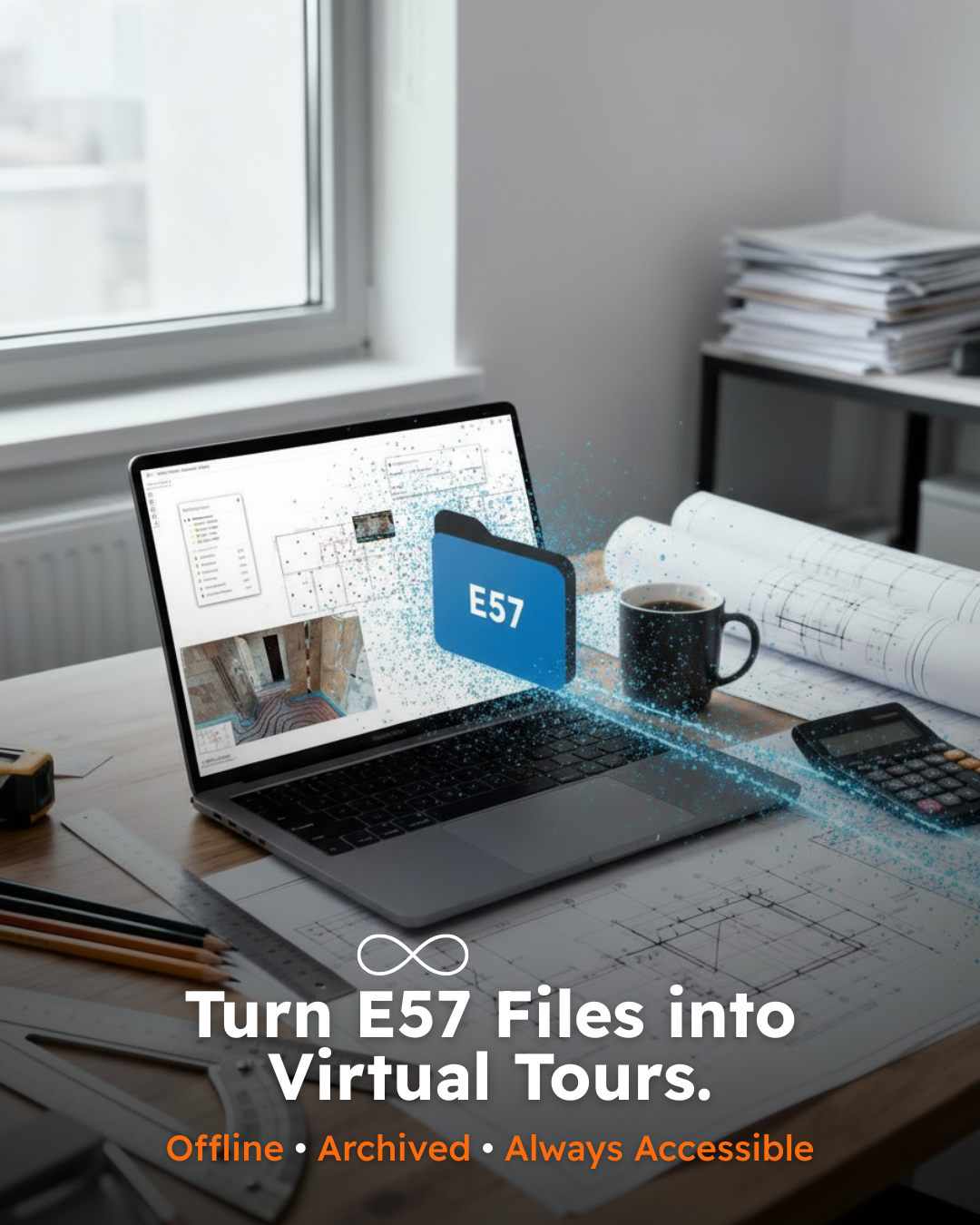
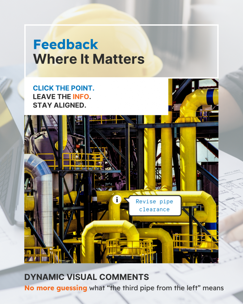
Viinplan delivers a comprehensive platform that empowers teams to visualize, manage, and share complex spatial environments across multiple devices. On the Windows application, users benefit from offline project access, high-performance 3D laser scan processing, and advanced measurement tools, ensuring productivity even without an internet connection. Meanwhile, the Cloud Desktop provides seamless collaboration, real-time updates, and secure cloud storage, allowing stakeholders to access projects, edit elements, and manage permissions from any modern browser. In addition, the Cloud Mobile app enables on-site navigation, panoramic image viewing, and data capture, giving teams flexibility in the field. Furthermore, Viinplan’s suite of features—including 360° site documentation, smart search, dynamic navigation, data integration, context-rich collaboration, granular access control, and support for multiple formats—ensures organizations can streamline digital project management, virtual tours, and 3D visualization workflows efficiently and securely.

Feature Windows app Cloud Desktop Cloud Mobile
Manage data (analyze/add/remove)
Storage management (upload / download)
Project Import / Export
Edit Project Structure
Place Elements including placeholders
Virtual Tour
View Scans, Panoramas, Images, PDF
Place Hotspots in Scans, Panoramas, Images, PDF
Run supported Windows applications
Measure functionality in Laser Scans
Open and download PDF documents
Info points management
Categories management
Share / Exclusion management
Account administration
Project administration

ON-PREMISES DEPLOYMENT

While our standard subscription packages are delivered as a secure, cloud-based SaaS solution, Viinplan also provides flexible deployment options to meet diverse organizational needs. For example, clients with advanced requirements, strict data policies, or complex IT environments can choose on-premises installations for greater control. Moreover, Viinplan’s platform offers a wide array of powerful features, including 360° site documentation, millimeter-accurate 3D laser scan support, panoramic image integration, CAD and PDF management, smart search, dynamic navigation, and granular access control with centralized permissions, ensuring teams can work efficiently and securely.

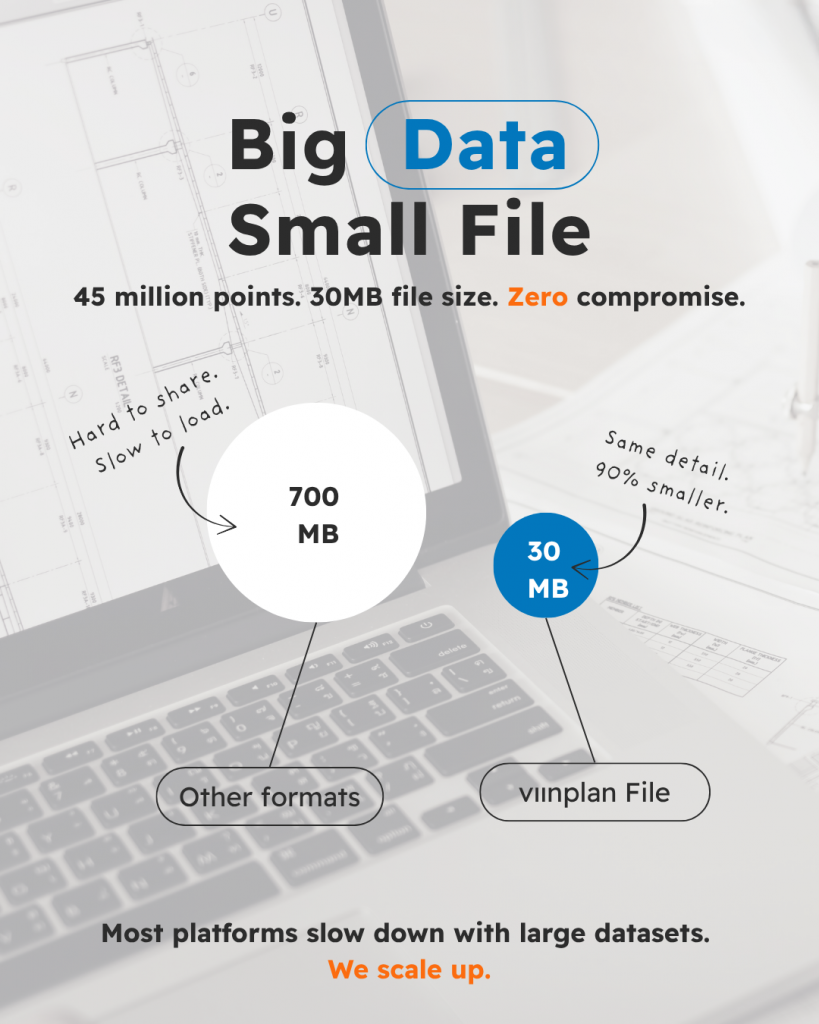
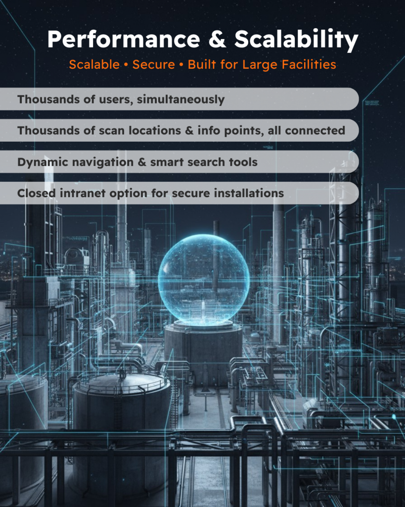
In addition, the platform is built for high performance and scalability, supporting thousands of scan locations, information points, and simultaneous users without compromising speed or reliability. Consequently, it ensures secure collaboration, real-time project updates, and full compliance with enterprise IT standards. By combining these capabilities, Viinplan further enables organizations to streamline digital project management, create immersive virtual tours, and implement advanced 3D visualization workflows, making it an ideal solution for industrial facilities, museums, rail networks, tunnels, and public buildings. Furthermore, its flexibility and robust architecture allow teams to adapt the platform to specific project needs, integrate multiple data sources, and maximize productivity across all stages of a project.

On-premises solution is ideal for organizations that:

  • Operate in highly regulated or security-sensitive industries
  • Require full control over data storage, access, and infrastructure
  • Need tight integration with internal systems or legacy software
  • Prefer in-house hosting within their own IT ecosystem

Enterprise-level capabilities and viinplan features, include:

  • LDAP/Active Directory integration for seamless user authentication and centralized access management
  • Linkable projects – enabling rich, interconnected environments that scale across departments, sites, or regions
  • Powerful performance – supports hundreds of simultaneous users and thousands of positions per project
  • Interconnected environments empower even the largest projects with a better organization, management and structure
  • Scalable structure – each project can handle thousands of positions, assets, or locations without performance degradation
  • Granular user permissions – manage access down to the individual object level, ensuring precise control over data visibility and editing rights
  • Revision control and project history – maintain a complete record of changes, with the ability to track and revert to previous states when needed

Contact us to learn how our custom deployment options can meet your technical, operational, and security goals.